Designing and building a custom home comes with certain variables. One of them is the permitting and review process. Local officials will want to review the plans to see that they comply with building codes and zoning ordinances. Historic districts, homeowners’ associations, and nearby neighbors might be empowered to weigh in as well.
All of these entities have a valid stake in what gets built. You will need someone who can effectively communicate with these stakeholders and present compelling visual evidence that requirements have been met and concerns have been addressed.
At Turkel Design, we have a proven track record of securing permits in notoriously challenging permitting environments, including Mill Valley, north of San Francisco. For this project, visualizations became an important tool for us to address two stakeholder concerns: lighting at night and construction traffic on narrow roads.
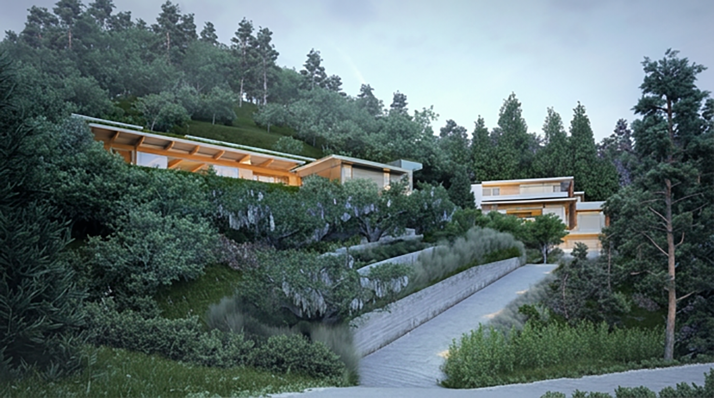
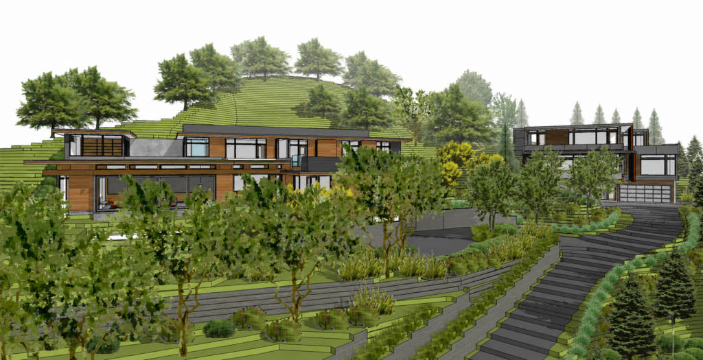
The building site was midway up a steep hillside, accessed by a driveway up from the street below. Our clients wanted to replace the house at the head of the driveway with two new homes, as allowed by the local zoning code. Here’s a view of our two proposed houses, in their context, with neighboring houses “ghosted in.”
Lantern Effect Studies
As you can see in the image above, this hilly terrain meant that some of the neighboring houses would be looking directly across at the new houses from their own hillside sites. This meant that, at night, light from the windows in our houses would be shining out toward the neighbors.
To address this, we modified our design by moving some windows and screening others. To convey the effects of these changes, we went into our digital site-model, took “photos” from the viewpoints of the surrounding houses, and produced visualizations of the “lantern” effect our modified windows would produce at night.
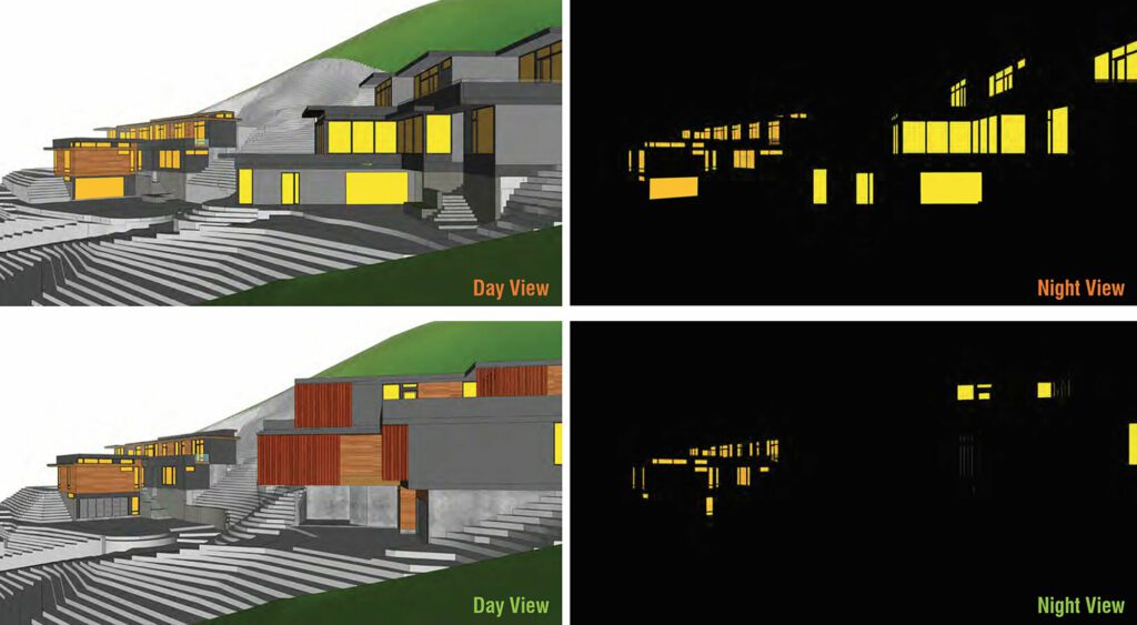
Our presentation convinced them we could mitigate the visual noise, and the project went forward.
Cut and Fill
Building a house on a steep hillside means inserting some part of that house into the hillside. This means that some part of the hillside has to be removed to make space for the house. But where does all that removed dirt go? In Mill Valley, that removed dirt can’t be trucked away: it has to be redistributed within the confines of the site itself. This is called “balancing cut and fill.”
But how do you convey this, in a visually compelling manner, to stakeholders? Here are a couple of images (constructed from our 3D model of the site) showing parts of the hillside being “lifted” to make way for our houses, and showing all of that dirt being spread around the two houses we proposed to build.
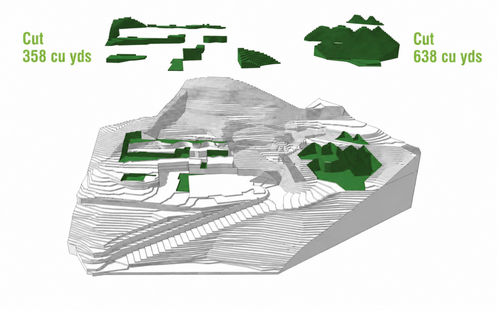
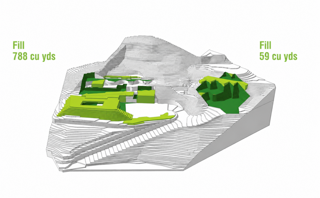
But there’s more: all that dirt can’t be suspended in the air during construction—it has to be put somewhere, within the site. Here’s a montage showing how we proposed shifting all that “cut,” back and forth, until it was ready to become “fill.”
The lantern studies convinced the neighbors that they’d be happy with the final build-out of our designs. The cut-and-fill diagrams convinced the city we had a plan in place to meet local regulations and minimize the amount of construction traffic on the roads.
Most importantly, our clients were able to build their new homes knowing they were starting out on the right foot with the city and their neighbors.
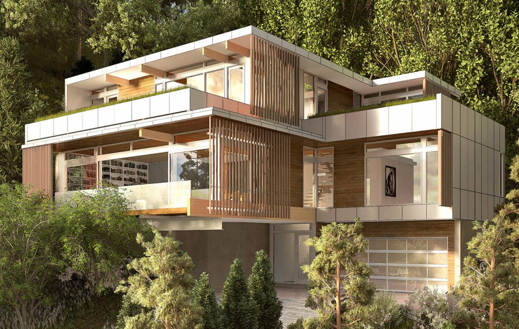
These custom homes each went through their individual design process. While one was conceived through a series of modifications to our Axiom 3250 design — an ideal starting point for steep terrain; the other was a completely custom design.
Whether it’s for this project in Mill Valley, or others in such similarly strict locales as Martha’s Vineyard, the Hamptons, Aspen, Napa Valley, and Hawaii, we identify the specific concerns of the local governing bodies, then seek inspired solutions that respond to both their needs and the needs of the homeowner. The result is always more nuanced, intentional architecture.
Interested in seeing some of the places where we’ve worked? Visit our portfolio for images of projects near and far.