Vous pourriez penser qu'une fois que votre architecte a dessiné les plans de votre nouvelle maison, la prochaine étape est de commencer à la construire. Pas si vite…
Les responsables locaux voudront examiner les plans pour s'assurer qu'ils sont conformes aux codes du bâtiment et aux ordonnances de zonage. Les districts historiques, les associations de propriétaires et les voisins proches pourraient être habilités à examiner les plans.
Toutes ces entités ont un intérêt valable dans ce qui est construit. Vous aurez besoin de quelqu'un qui peut communiquer efficacement avec ces parties prenantes et présenter des preuves visuelles convaincantes qui les exigences ont été remplies et les préoccupations ont été prises en compte.
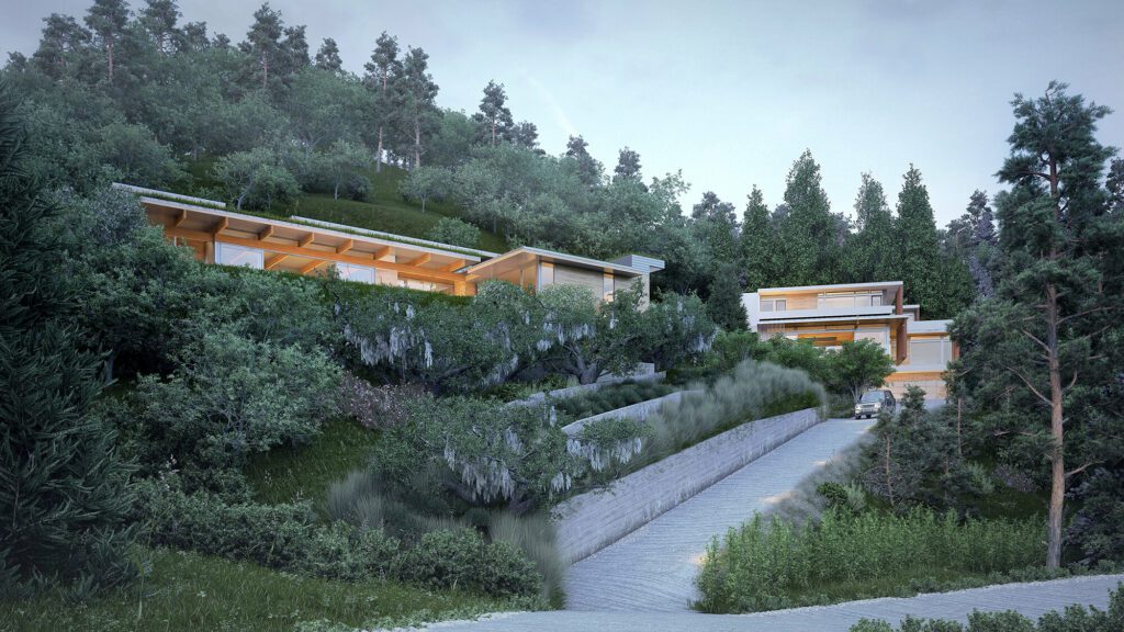
Pour un projet récemment achevé à Mill Valley, au nord de San Francisco, les visualisations sont devenues un outil important pour répondre à deux préoccupations des parties prenantes : l'éclairage la nuit et le trafic de construction sur les routes étroites.
Le chantier était à mi-hauteur d'une colline escarpée, accessible par une allée depuis la rue en contrebas. Nos clients voulaient remplacer la maison à la tête de l'allée par deux nouvelles maisons, comme le permet le code de zonage local. Voici une vue de nos deux maisons proposées, dans leur contexte, avec des maisons voisines "fantômes".
Études d'effet de lanterne
Comme vous pouvez le voir sur l'image ci-dessus, ce terrain vallonné signifiait que certaines des maisons voisines regarderaient directement les nouvelles maisons depuis leurs propres sites à flanc de colline. Cela signifiait que, la nuit, la lumière des fenêtres de nos maisons se dirigeait vers les voisins.
Pour résoudre ce problème, nous avons modifié notre conception en déplaçant certaines fenêtres et en masquant d'autres. Pour rendre compte des effets de ces changements, nous sommes entrés dans notre site-maquette numérique, avons pris des ?photos? des points de vue des maisons environnantes, et produit des visualisations de la ? lanterne ? effet que nos fenêtres modifiées produiraient la nuit.
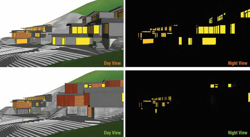
Notre présentation les a convaincus que nous pouvions atténuer le bruit visuel, et le projet a avancé.
Couper et remplir
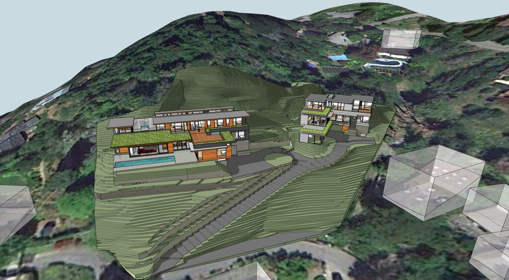
Construire une maison sur une colline escarpée signifie insérer une partie de cette maison dans la colline. Cela signifie qu'une partie de la colline doit être enlevée pour faire de la place à la maison. Mais où va toute cette saleté enlevée ? À Mill Valley, cette saleté enlevée ne peut pas être transportée par camion : elle doit être redistribuée dans les limites du site lui-même. C'est ce qu'on appelle ?l'équilibrage du déblai et du remblai.
Mais comment transmettre cela, d'une manière visuellement convaincante, aux parties prenantes ? Voici quelques images (construites à partir de notre modèle 3D du site) montrant des parties de la colline en train d'être "soulevées". pour faire place à nos maisons, et montrant toute cette saleté répandue autour des deux maisons que nous avons proposé de construire.
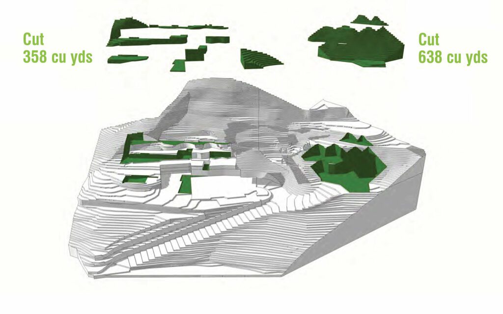
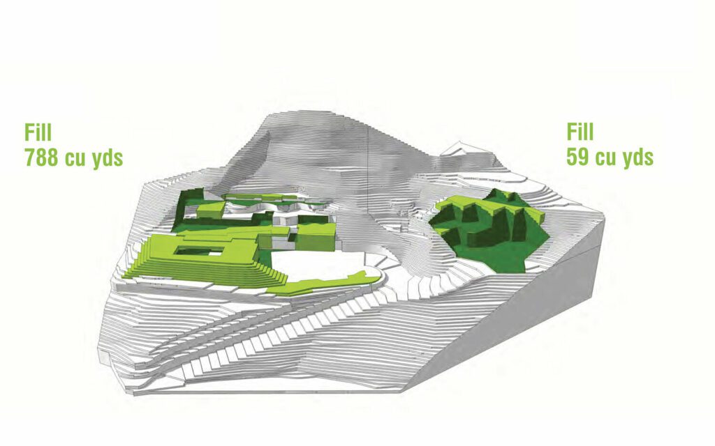
Mais il y a plus : toute cette saleté ne peut pas être suspendue dans l'air pendant la construction, elle doit être placée quelque part, à l'intérieur du site. Voici un montage montrant comment nous avons proposé de décaler tout ce "coupé",? d'avant en arrière, jusqu'à ce qu'il soit prêt à devenir "remplir".
Les études de la lanterne ont convaincu les voisins qu'ils seraient satisfaits de la construction finale de nos conceptions. Les schémas de déblai et de remblai ont convaincu la ville que nous avions un plan en place pour respecter les réglementations locales et minimiser la quantité de trafic de construction sur les routes.
Plus important encore, nos clients ont pu construire leurs nouvelles maisons en sachant qu'ils partaient du bon pied avec la ville et leurs voisins.
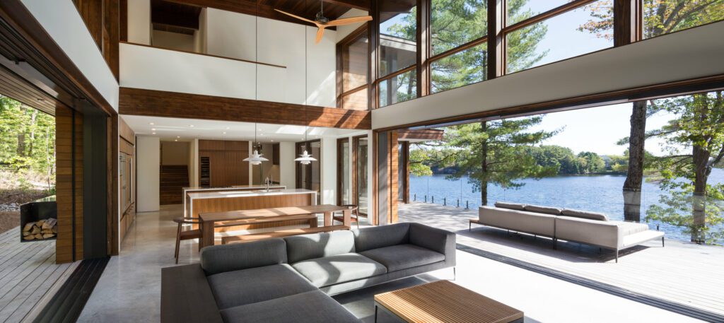
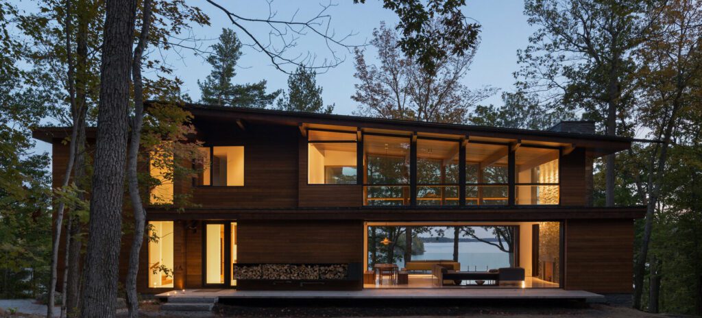
Ces maisons personnalisées sont chacune passées par leur processus de conception individuel. Là où l'on a été conçu par un série de modifications à notre Axiome 3250 motif ? un point de départ idéal pour les terrains escarpés; l'autre était une conception entièrement personnalisée.
Intéressé à voir certains des endroits où nous avons travaillé ? Visitez notre portefeuille pour des images de projets proches et lointains.